

Map of Norfolk
This Norfolk map will help you plan your days out and discover the finest attractions Norfolk has to offer. Norfolk is a wonderful place to visit at any time of the year.
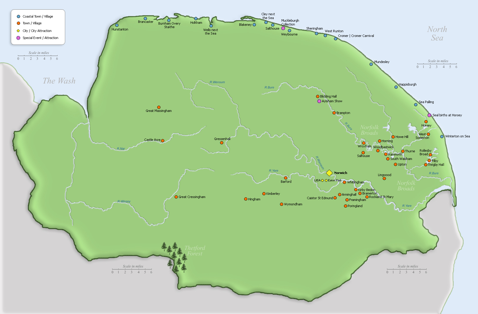
This Norfolk map will help you plan your days out and discover the finest attractions Norfolk has to offer. Norfolk is a wonderful place to visit at any time of the year.
Highlighted in blue on the map are the Norfolk Broads. In total they comprise of about 120 miles of navigable waterways – seven rivers and 63 broads.
The North Norfolk Coast has been designated an Area of Outstanding Natural Beauty.
The fine city of Norwich is Norfolk’s capital with a fascinating medieval history. It boasts a Castle and two Cathedrals!
Norfolk is located in the East of England, in an area known as East Anglia. Norfolk can be reached by car, train or air travel. It is roughly 75 miles North East of London. Norfolk’s neighbouring counties include Cambridgeshire, Lincolnshire and Suffolk. The North Sea surrounds Norfolk’s beautiful coastline.
Travelling in Norfolk
Norfolk has an excellent road network with major routes to and from the City of Norwich that branch out to four main areas; Broadland in the East, Breckland to the West, The North Norfolk Coast and South Norfolk.
The Coasthopper bus service is a dedicated bus service that runs along the Norfolk Coast providing an alternative option to walking.
National Rail – Norwich train station provides a great central location for arriving in Norfolk with further rail routes to Sheringham and Great Yarmouth.
Norwich Airport links Norfolk to popular European destinations and the Mediterranean plus UK connections to Aberdeen, Edinburgh, Exeter and Manchester.
 Norfolk Map
By continuing to use the site, you agree to the use of cookies. more information
The cookie settings on this website are set to "allow cookies" to give you the best browsing experience possible. If you continue to use this website without changing your cookie settings or you click "Accept" below then you are consenting to this.